Mayfield Mines
Mine Subsidence and Flooding in Newcastle
-
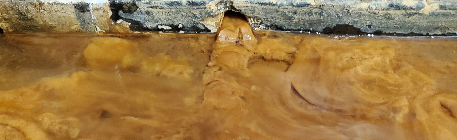
Mine Water in Walls
Permanent mine water flowing through wall cavities.
-

Warehouse Derelict for 15+ Years
The Valuer General continues to reject flooding & mine evidence, and has again increased the land value.
Mine Subsidence and Flooding in Newcastle Mayfield Mines
For over 15 years, we experienced mine subsidence and mine water flooding from abandoned mines in Mayfield, Newcastle. The 2 problems;
1) Mine Subsidence under our properties from the Spennymore Colliery.
2) Mine water flooding in our properties caused by Spennymore Colliery and Ferndale Colliery.
Mine subsidence is the responsibility of Subsidence Advisory NSW. Mine water flooding work is allocated to Legacy Mines NSW. The problems have been transferred amongst these offices.
For over a decade, Subsidence Advisory has told us there are no mine workings under our buildings and the subsidence damage is not mine related. Whilst Legacy Mines believed the 20,000,000 litres of mine water running into our properties each year were not from legacy mining.
Latest News
-
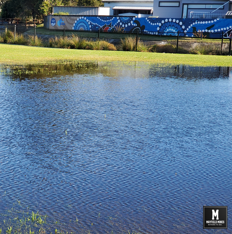
City of Newcastle Council Not Interested to Investigate Flooding In Newcastle
A Newcastle Council environmental officer visited on Friday to inspect the flooded Litchfield Park. Not only have senior Newcastle Council officials been fully aware of the flooding problems for many years, but, they have ignored efforts to find a solution. In 2020, the Deputy Premier understood there were issues in Mayfield East and contacted the […]
-

Solving Mine Water Flooding in Mayfield Not in the Public Interest – Minister Courtney Houssos
According to the Minister Courtney Houssos (Minster for Nature Resources), the mine water flooding in Mayfield (and other suburbs) “does not affect public health or safety, nor does it affect the local environment“. As per NSW Government goals, the primary objectives of the Legacy Mines Program are to: reduce or eliminate risks to public health […]
The Merry Go Round
Evidence collected suggests that poor mining practices created a unique situation where all abandoned mines in the area are interconnected and full of water, from Mounter Street to Litchfield Park. These old mines are often shallow in depth, and as they subside, they cause damage to infrastructure with water from broken stormwater and Hunter Water pipes feeding extra water in the mine system which then flows into our properties.
Dye placed in stormwater pipes found its way into our property, when broken water mains opposite our properties were fixed, water significantly stopped flowing into our properties. Each time we showed the information to the government agencies, they further restricted information to us or avoided us completely.
We have collapsed walls, twisted door jams, broken windows, subsidence in slabs, and much more. Subsidence Advisory tell us it’s not mine related and that the properties are not undermined and to work with Legacy Mines who tell us they have low to nil priority to help us.
Over time, all these departments have blamed each other whilst avoiding having a “round table meeting” to address the situation.
The facts are that the NSW government manage the abandoned mine network, and various government agencies, acknowledge that mine subsidence has occurred, and mine water is flooding our buildings caused by broken government assets. No matter what department is being blamed, all are owned by the NSW government.....15+ years of merry-go-round.
The Latest Information…..
Established in 2003, Converters.tv is closing down.
Established in 1996, Highway Entertainment is closing down.
More news soon....