Mayfield Mines

A Mine Subsidence and Flooding Problem in Newcastle

  • News
  • About Us
  • Support Us
    • Join Our Team
  • Contact Us

Tarin Street Mine is the Water Source?

May 18, 2023

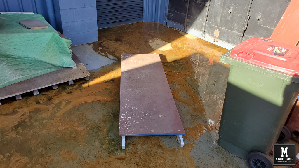
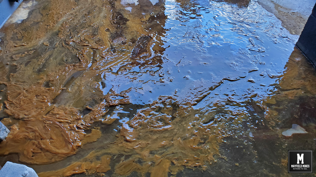
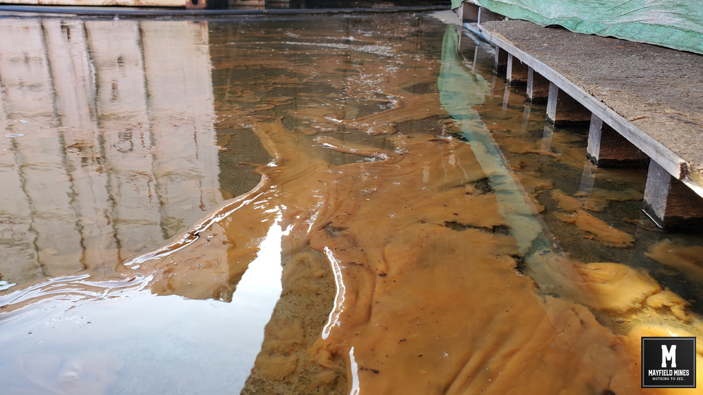
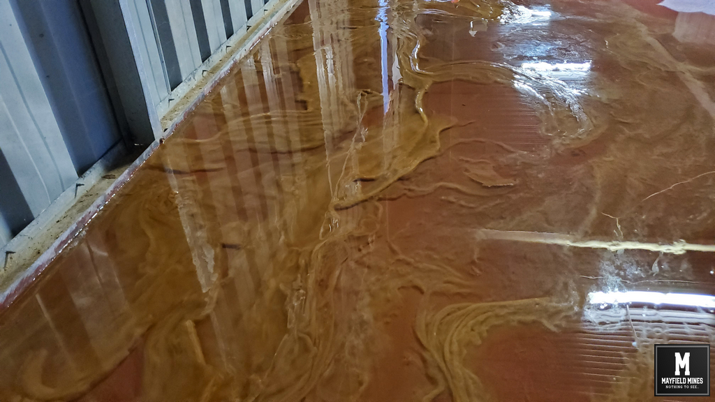
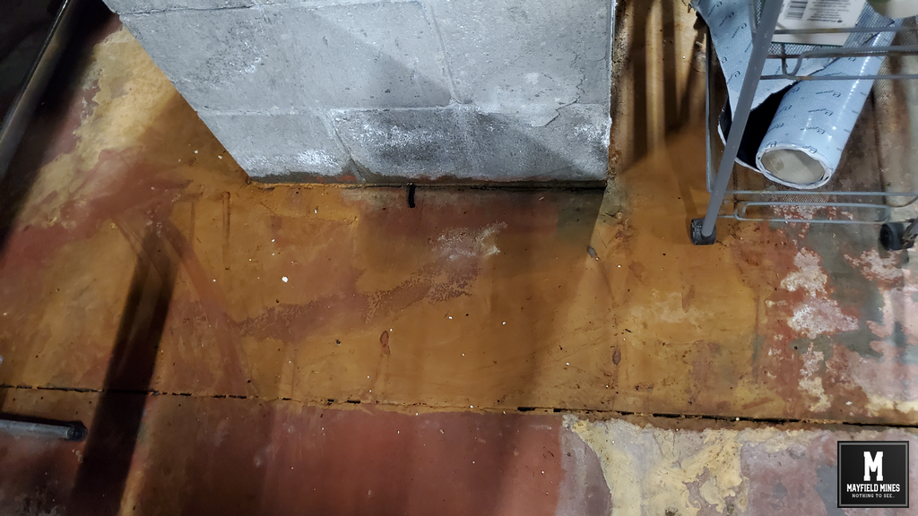
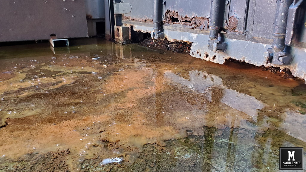
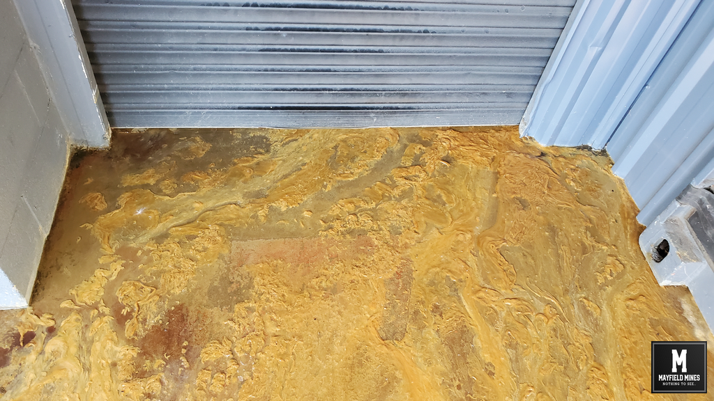
We take up the story in January 2015 where water is streaming inside our warehouse from under Maitland Road, Mayfield. At this time we don’t fully understand where the water is coming from but the intensity has increased and flowing from a number of locations out of the soil wall. One submersible pump is not enough to remove the water, so we installed 2 pumps. In this video water is not only coming from multiple locations to the left, but also from the centre of the soil wall, and, from the right of the soil wall. We contact Newcastle Council, and chase very hard for support. At the end of 8 weeks chasing…”XXX is the first point of contact, but he is on holidays”.

Many months later, and having no clear response from Newcastle Council, we ask help from both the Mayfield Business Association and lobby Councillor Tierney to investigate the situation. Newcastle Council’s ultimate findings are;

• An old 1960’s telegraph pole is the cause of the sinkhole in front on the property along Maitland Road. This was also the cause of the sinkhole in 2012 (according to Newcastle Council), and Newcastle Council will again say that this telegraph pole is the cause of another hole in 2019 and 2020. More about the moving telegraph pole later.

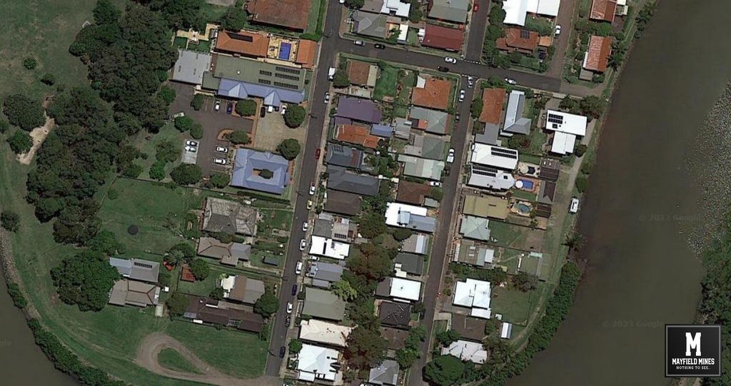
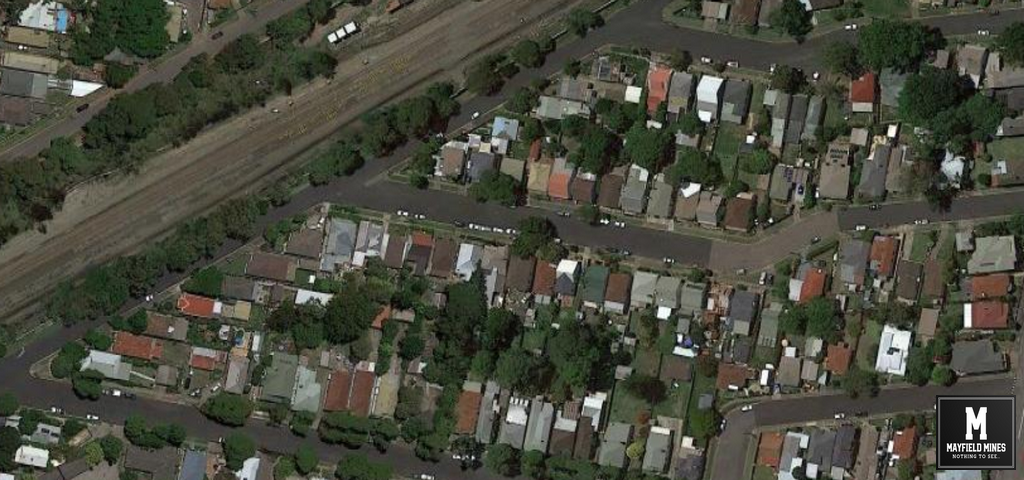
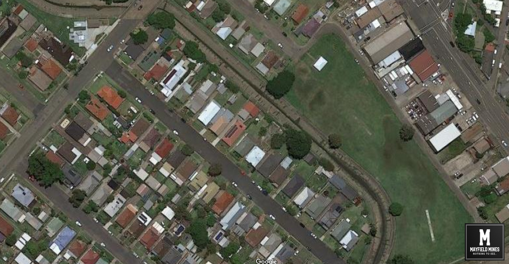
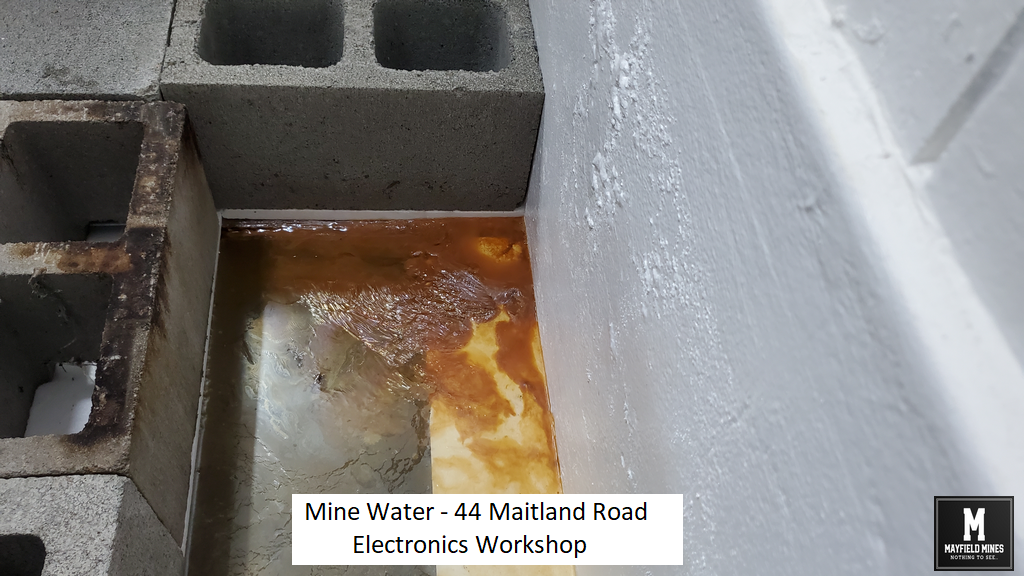
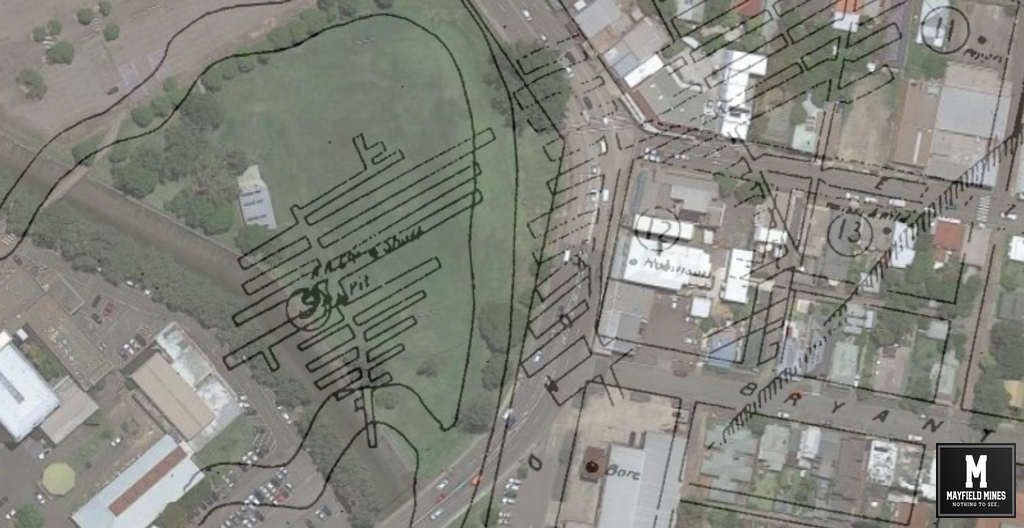
• That possibly underground mine workings in Tarin Street might be the cause.

• The case was then closed by Newcastle Council.

And from freedom of information records, Newcastle Council notes are as follows;

I advise that a review of Council records reveal no underground drainage assets are located across the frontage of your property and there are no council assets in the vicinity of the property that would result in water infiltration into the building.

In addition I can confirm that we are drainage pits across the road, however they do not run towards the property, furthermore there is a drainage easement located at 44 Maitland road which is a significant distance away from the property and is down slope from the property.

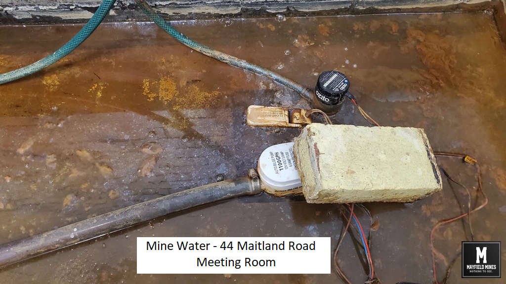
As such the seepage flows within your property are possibly emanating from old mine workings or an underground spring, and is not associated with the underground pipe drainage system.

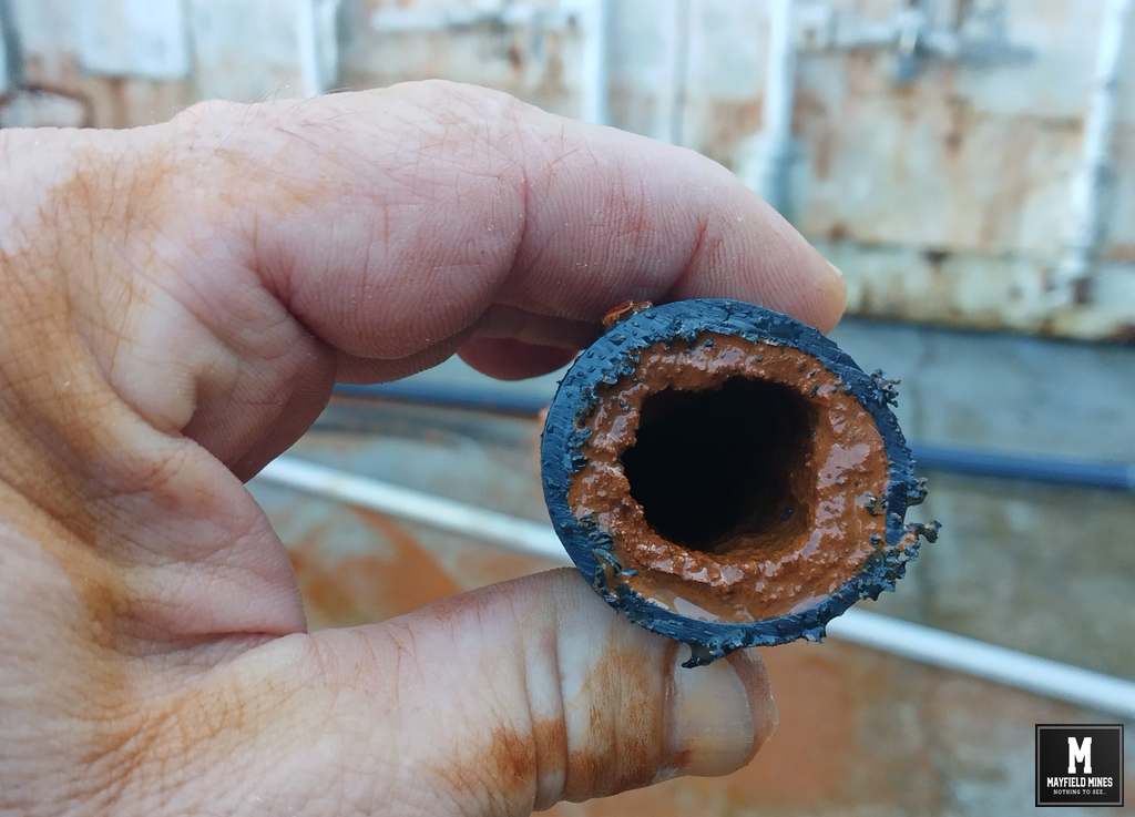
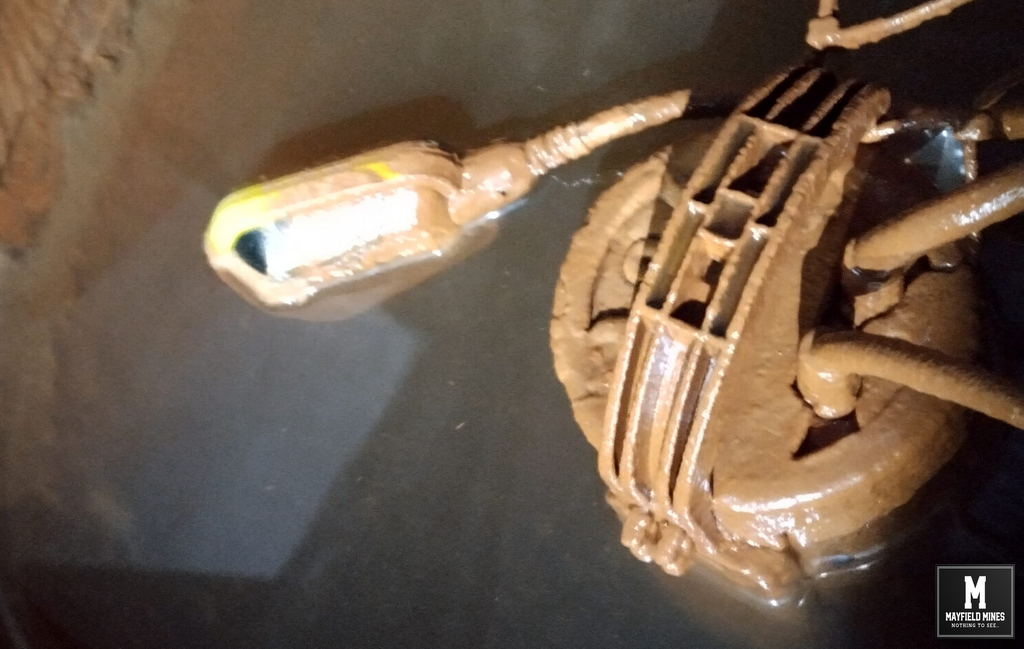
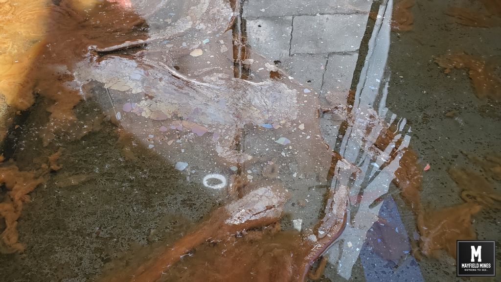
Green dye that was placed in the stormwater network across the road found its way into our property.

Tarin Street Mine

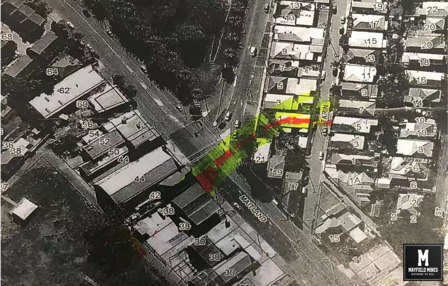
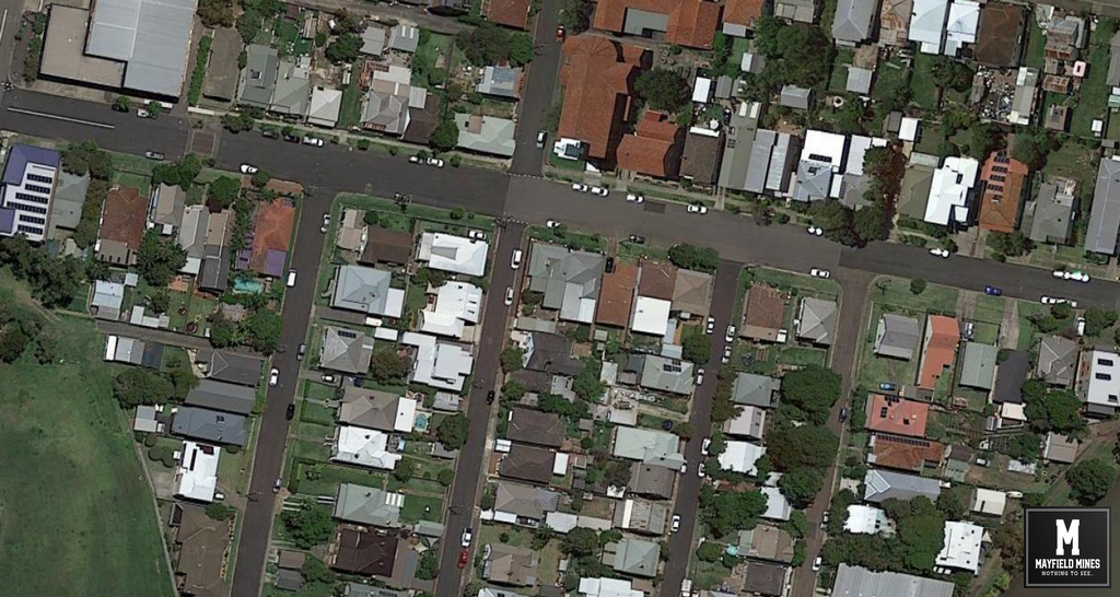
Tarin Street Mine Water Source ?

Filed Under: Legacy Mines NSW, Mine Subsidency Advisory NSW, Newcastle City Council, NSW Government

Daily Maintenance to Keep Doors Open

May 12, 2023

Whilst our 38 Maitland Road Mayfield property is completely out of action, we still need to handle daily maintenance on this building as well as at the other buildings. This includes daily jobs such as mopping up excess water, cleaning pipes/pumps or solving subsidence issues – when door jams no longer can open/close properly, we are continuously adjusting hinges, door jams, and door locks in order to keep the office open.

In today’s photos we are showing the cleaning of the submersible pumps and hoses. If we do not handle this work, water immediately fills the properties with brown sludge that then travels through the carpark and onto the road making it very slippery and dangerous.


Mine Water Staining Pipe

Mine Water Staining Pipe


Mine Water Staining Pump

Mine Water Staining Pump

Filed Under: Legacy Mines NSW, Newcastle City Council

Take A Closer Look – Road Repairs

May 12, 2023

Its hard enough to have Newcastle Council repair a pothole.  So how do you explain rows and rows of streets being repaired in our area?

If we had an open and transparent mine subsidence authority and related government agencies, we could quickly cross correlate data showing public assets (stormwater, sewer, drinking water, data cables, etc..) and how the legacy mines are impacting on these services.

What is Newcastle’s pro-active mine subsidence policies for the old abandoned mine network – or, do we wait for damage first, then repair, then wait for the damage to return, then repair again….?


Mine Subsidence Road Repairs

Mine Subsidence Road Repairs? – Mayfield East


Subsidence Repairs Tighes Hill

Subsidence Repairs Tighes Hill?


Tighes Hill Road Repairs

Tighes Hill Road Repairs?


road repairs Mayfield

Road Repairs Mayfield?


road repairs Mine Subsidence

Road Repairs Mine Subsidence


Filed Under: Legacy Mines NSW, Mine Subsidency Advisory NSW, Newcastle City Council

Mine Water Undermining Warehouse

May 12, 2023

Mine water from abandoned mines is destroying our buildings.

Mine water is flowing permanently from abandoned mine workings that are located under the footpath and Maitland Road. The mine water runs into catchment pits we have created, and then this water is pumped into the drains. The mine water you see in this video is water we cannot catch and is sitting under the concrete slab and “seeping” out of the expansion joints.

We have 8 locations the mine water is running into our warehouse property.


Filed Under: Legacy Mines NSW, Mine Subsidency Advisory NSW, Newcastle City Council, NSW Government

Mining Techniques in the 1800s

May 4, 2023

Below is an extract from the Royal Commission in 1886 where the commissioners chatted with the manager of Ferndale Colliery;

65. You have worked the coal under the Maitland Road, I believe? Yes.
66.. What depth is the coal from the surface under that road? It is about 1.5 feet from the surface down to the roof of the coal.
67. Of what rock is the roof composed ? Soft past.
68. And to the south -west of the Maitland Road, what is the depth of the coal ? It crops out just beyond the Maitland Road.
69. In that swampy hollow formed by the elbow of. Tighe’s Creek, is the coal found? Yes, it is found in the swampy hollow at Tighe’s Cheek.
70. Then, between the Ferndale workings the outcrops to the south-vest of the Maitland Road, has the coal been worked by other parties ? It was last worked by Mr Bevan, and by Chas.  Austin, and several small owners.
71. Are the workings of these small collieries connected with those of Ferndale? Yes.
72. Were any barriers left between them ? I left a barrier of coal between Tighe’s Hill and Peppertown.
73. But in these little collieries that you have spoken of, do you know what Was the nature of the surface deposits above the coal -seam ? It was clay and conglomerate, and in the crop it would be mostly composed of this rotten post, with a body of clay on the top of it.
74. Do you know whether these surface deposits gave these owners any trouble? I do not think so.
75. Was the surface of the crop-workings covered by the tide in that position ? No.
76. Have the pillars in these collieries been taken out? Yes we took out all the pillars in Peppertown.
77. But I am now speaking of these little collieries? ‐ Yes the pillars were taken out.
78. Did they take them out to the very crop? Yes, they took all they could.
79. Then these collieries being connected with Ferndale, will now be drowned out? ‐ Yes; every one of them.
86. On looking at your tracing of the plan, the coal workings are represented to terminate abruptly and follow a curved line,‐does this curved line represent the position of the outcrop?‐ Yes.
87. This is where the coal has become lost in the level deposits? Yes.
91. And did the surface come down and cut out the conglomerate? Yes.
92. Then in that case what was in front of the coal seam? Sand and clay.
96. Towards the crop, did the conglomerate give place to sand suddenly or gradually? Sometimes there would be a portion of post in it. Sometimes it would be 6 or 7 inches, and in others as high as a foot, and cut out the conglomerate.
97. When you struck the surface deposits to the north‐west and north, did these deposits give you any trouble? Only in one portion of the mine.
98/99. Have you taken out the whole of the pillars in this section? …. I mean that section to the west? We have taken out all the pillars to the west of Waratah Railway, excepting under the Maitland Road.
100. Did you experience any difficulty from the surface in doing so? No.
101. What measures did you take to prevent it filling up the workings? We took no measures at all. We took the pillars out and let it fall.
102. Was there any surface‐water? None whatever.
103. Contiguous to the shaft I believe you experienced some difficulty from “cave‐in” Did it give you some trouble? Yes.
104. Would you tell us about it? In the flat of Tighe’s Hill, in four different places, the roof fell in, and worked out to the crop, so that there was no covering to support the crop, and we had to construct a dam to keep the water back.
105. Did any water come in along with the sand? Yes; a considerable quantity came in, but we made these dams, and kept it back.
106. I understand this part of the workings is above tidal influence? Yes; But there is a great body of water in the sand, down about 15 feet.
119. Had you any considerable growth in water from the Ferndale workings? Yes.
120. Where did the water come from? From a flat in the old workings to the west of Ferndale shaft.
121. How much water did you get? We were pumping in No8 16,000 gals. an hour.
161, And you have told us that you pumped 16,000 gallons an hour from that pit ‐ was the water fresh or salt? It was salt water.
162. Where did it come from? Principally from the hard roof of conglomerate.

Ferndale Colliery

Ferndale Colliery

Filed Under: Legacy Mines NSW, Mine Subsidency Advisory NSW, NSW Government

Mine Water from Abandoned Mine Workings

May 4, 2023

Permanently flowing from under Maitland Road Mayfield we have mine water coming from abandoned mine workings.

Mine Subsidence Authority suggests the water is coming from old mine workings that were abandoned in the 1800s. Over the last years, the mine water in these abandoned mines has spread from one building, to now affecting all 3 buildings. It has also spread to our neighbours properties as well as Myola Street and Litchfield Park.


abandoned mine water

abandoned mine water

mine water 38 Maitland Road Mayfield warehouse

mine water 38 Maitland Road Mayfield warehouse

mine water 38 Maitland Road Mayfield Carpark

mine water 38 Maitland Road Mayfield Carpark

mine water 38 Maitland Road Mayfield Carpark

mine water 38 Maitland Road Mayfield Carpark

mine water 38 Maitland Road Mayfield warehouse wall

mine water 38 Maitland Road Mayfield warehouse wall

mine water 38 Maitland Road Mayfield warehouse pillar

mine water 38 Maitland Road Mayfield warehouse pillar

mine water 38 Maitland Road Mayfield containers

mine water 38 Maitland Road Mayfield containers

mine water 44 Maitland Road Mayfield workshop

mine water 44 Maitland Road Mayfield workshop

Meeting Room Water A

Meeting Room Water A

mine water 38 Maitland Road Mayfield warehouse entrance

mine water 38 Maitland Road Mayfield warehouse entrance


Filed Under: Legacy Mines NSW, Mine Subsidency Advisory NSW, Newcastle City Council, NSW Government

Mining Under Maitland Road Tighes Hill

May 3, 2023

From the Royal Commission;
 
It appears that No.2 south headings were commenced with the ulterior intention of working out a considerable area of coal owned by the company south of Tighe’s Terrace street, and probably, also, of anticipating some of the small colliery owners referred to in working the coal from under the Maitland Road in the direction of the bridge across that creek.
 
The colliery officials, on being interrogated on the point, affirmed that these bords, on reaching the western fence of the road, were stopped. Mr Inspector Dixon, however; suspected that these bords had crossed the road, and had been driven towards or under the creek, which here forms a sharp elbow, and sweeps under an escarpment of conglomerate.
 
On being called upon to do so, Mr. Mackenzie, Examiner of Coal-fields, produced a plan of older date than the one put into the hands of the Commission, in which the faces of the bords under review were shown to cross the road, and were stopped under the bed or channel of Tighe’s Creek.
Upon. this low-lying and flooded land, nearly opposite Bryant-street, and about 2 chains from the margin of the creek, a small colliery (now owned by Messrs Broughall. &Griffiths) has been sunk.

The depth of the shaft, is only 23 feet to the top of the coal-seam, and, like Ferndale, is entirely composed of fluviatile or estuarine deposits. Some bords worked from this colliery had been pushed under Tighe’s Creek towards Ferndale workings ; And one bord, shown on No. 1 plan, has reached within 10 or 11 yards of the advanced workings from the last-named colliery at the date of the inundation (18th -March, 1886).

The uncertainty that existed as to the correctness of the underground plans, and the terrible nature of the catastrophe that had occurred to the adjoining collieries, presumably acted as an incentive to the Government officials to serve notices upon Messrs. Broughall. & Griffiths to cease working.; and, although the Law Officers of the Crown, probably with reason, did not see their way clear to place an injunction on these gentlemen to cease working, the action taken has has the good effect of preventing any further work in the bords approaching Ferndale  from being prosecuted.

Maitland Road Mining Tighes Hill

Maitland Road Mining Tighes Hill

Filed Under: Legacy Mines NSW, Mine Subsidency Advisory NSW, Newcastle City Council, NSW Government

Bailers Needed to make Mine Workable before Accident

May 3, 2023

From the Royal Commission;

A few months before the accident as many as twenty-one water-hailers were required to keep the working-places and roads in a comfortable and passable condition.

Two special steam-pumps were placed at the bottom of the pumping-shaft that forced about 16,000 gallons of water per hour to the surface. These pumping-engines were supplied with steam from boilers on the surface.


Ferndale Colliery Tighes Hill

Ferndale Colliery Tighes Hill


Filed Under: Legacy Mines NSW, Mine Subsidency Advisory NSW, Newcastle City Council, NSW Government

Full Hydraulic Connectivity – Mayfield Mines Permanently Flooded

May 3, 2023

From the Royal Commission;
“To the south and east, and in close proximity to this shaft, three small collieries have worked the coal from under a number of building allotments, leaving no barriers.
The workings to the west of these “headings” approached the Maitland Road, and a ‘spirited rivalry or competition seems to have existed among the conterminous small collieries as to which could work the greatest area of coal from under this important thoroughfare.
No restrictions seem to have been imposed on the workers. In consequence, this road has been honeycombed with workings for a considerable distance, and is at present supported by pillars so thin as to be almost invisible.
It is alleged by the owners of Ferndale that they left a sufficient barrier of solid coal around each of the small collieries shown on plan, No. 1 Appendix, but that this barrier, as well as the top-coal, and as many of the pillars as could be got at, were removed by these small owners; and in this manner – and by reason of their own thoughtless cupidity – the twenty small collieries, or thereabout, on this ridge have been communicated with each other.
As a result of these inter-communications, when Ferndale was inundated the whole of these collieries were filled with water.”
—–
134 years later, Professor Fityus in his report to Legacy Mines confirmed that “All mine workings in the area are likely to have full hydraulic connectivity”.
So does this mean that due to poor mining practices, all mines have been connected together, left unattended since the 1800s and purposely kept quiet from land owners?……more about this later.
Maitland Road Mining Mayfield

Maitland Road Mining Mayfield


Filed Under: Legacy Mines NSW, Mine Subsidency Advisory NSW, Newcastle City Council, NSW Government

Royal Commission into Collieries 1886 Newcastle

May 3, 2023

Before we explain our current situation, its important to understand the historic legacy mines in our area. With the great help of the Royal Commission into Collieries document, I will be quoting word for word abstracts. Later, I will use current day reports and evidence to match with historical data.

The Royal Royal Commission into Collieries 1886 was initiated because of the Lithgow Valley and Ferndale Colliery disasters and a near disaster at Maryville Colliery in 1886. With regards to Ferndale Colliery (the major colliery in the Tighes Hill region), on the 18th March 1886 a miner drowned and “water had flooded the mining plant and works as well as adjacent small collieries and were irretrievably lost”.

Below from the report;

“At the present moment the summit and sides of this ridge present a scene of confusion, caused by innumerable pit-falls, denoting where attempts have been made to remove the small-sized pillars of coal that supported the roof.

The Maitland Road crosses the southern margin of Tighe’s Hill. Under it the coal-seam measures 16 feet in thickness, and is found under the surface at a similar depth.
The coal has been worked from under this road, but the thin pillars have not been removed, and these at present form its sole support. Towards the west (opposite Bevan’s and Spennymoor* ) the coal crops out under the creek, and has been worked to within a few feet of its tidal waters.

The pillars that maintained the integrity of the surface have subsequently been removed, and the water has obtained access to the workings, and rises and falls every tide.”

* Spennymoor is the colliery that Professor Fityus referred to in his Legacy Mines report 2020 as being the workings underneath our properties.


Maitland Road Mining

Maitland Road Mining

Filed Under: Legacy Mines NSW, Mine Subsidency Advisory NSW, Newcastle City Council, NSW Government

  • « Previous Page
  • 1
  • 2
  • 3
  • Next Page »

Copyright © 2025