Mayfield Mines

A Mine Subsidence and Flooding Problem in Newcastle

  • News
  • About Us
  • Support Us
    • Join Our Team
  • Contact Us

Solving Mine Water Flooding in Mayfield Not in the Public Interest – Minister Courtney Houssos

June 9, 2025

According to the Minister Courtney Houssos (Minster for Nature Resources), the mine water flooding in Mayfield (and other suburbs) “does not affect public health or safety, nor does it affect the local environment“.

As per NSW Government goals, the primary objectives of the Legacy Mines Program are to:

  • reduce or eliminate risks to public health and safety;
  • reduce any impacts to the environment;
  • stabilise and prevent further degradation of legacy mine sites; and
  • remove or contain contamination at its source and prevent it from spreading.

The secondary objectives are;

  • detailed site assessments and preparation of remediation action plans
  • engineering design work
  • physical safety works (for example, fencing, grating or filling shafts)
  • erosion and sediment control works
  • management of acid mine drainage and contamination
  • stabilisation and revegetation of sites
  • monitoring and review remediation works

In 2020, a Legacy Mines report on “Groundwater Conditions at 38 Maitland Road Mayfield” exposed a network of abandoned mine working in Mayfield, which is causing subsidence damage to properties and government assets. That water from broken Hunter Water pipes are filling an already flooded mine system, which is then causing in the community including our properties. This mine water flooding is evident throughout Mayfield. During this Legacy Mine investigation, Subsidence Authority NSW withheld geotechnical information even though it had been asked many times by various government departments.  Whilst the Legacy Mines showed evidence that the problems were affecting the entire community, it was ignored.

Fast forward to 2025.

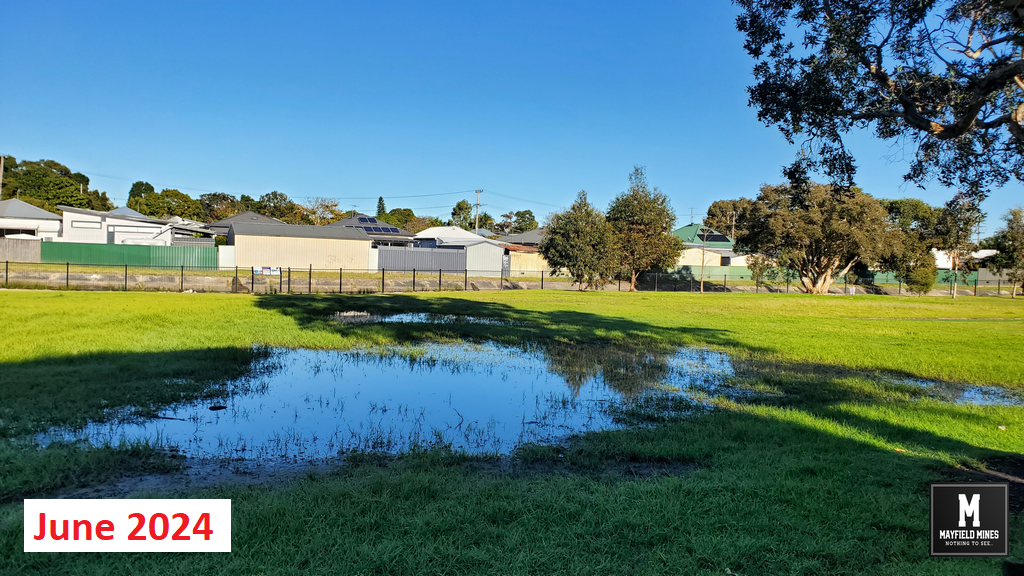
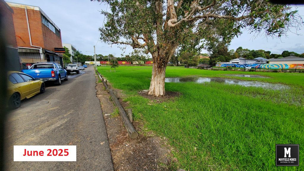
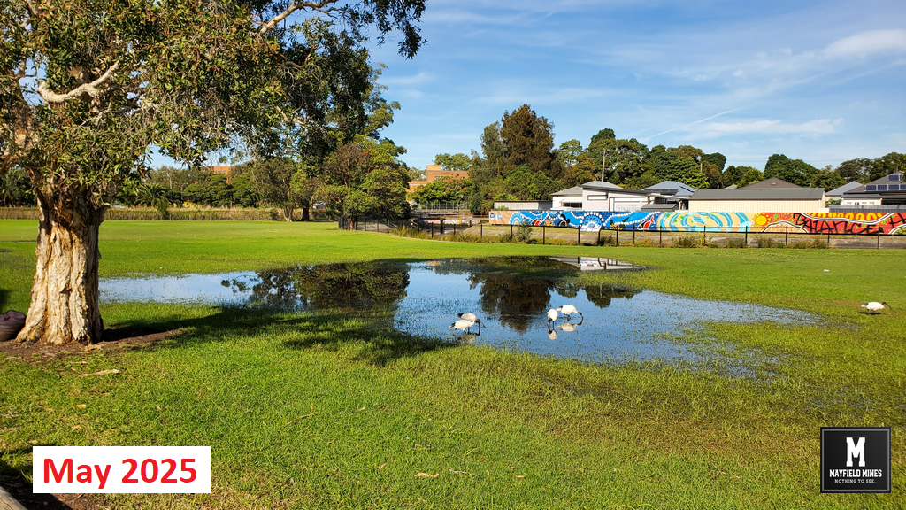
The problem of mine water flooding in abandoned mine workings cannot be hidden any longer. Neighbouring properties are now also pumping mine water out of their flooded properties, the footpath and roads are continuously subsiding and Litchfield Park is permanently flooded.

If the problem is widening, affecting multiple properties, causing damage to government assets, and spreading….how is this not in the public interest?

Litchfield Park May 2024

Litchfield Park May 2024 Flooding

Litchfield Park May 2025

Litchfield Park May 2025 Flooding

Litchfield Park June 2024 2

Litchfield Park June 2024 Flooding

Litchfield Park June 2025

Litchfield Park June 2025 Flooding

Filed Under: Legacy Mines NSW, Newcastle City Council, NSW Government, Uncategorized

Legacy Mines NSW Not Responsible for Mine Water Flooding?

June 9, 2025

We contact Legacy Mines on 16th October 2019, and asked for help but we are ignored. In December 2019, mine water has found its way to the ground floor of 44 Maitland Road flooding the entire floor and closing our office. Its been two months waiting for Legacy Mines to make a site inspection, they are not coming.

After the flooding of our office, we again contacted Legacy Mines and talked with Nick Staheyeff (Manager Legacy Mines, Department of Planning) who informs us that he does not believe our problem is within their charter.

So who is responsible for mine water coming out of abandoned mines and flooding properties?

It seems no one.

Mine Water Office

Mine Water Office


Filed Under: Legacy Mines NSW, Mine Subsidency Advisory NSW, Uncategorized

NSW Resource Regulator Approves Release of Abandon Mine Maps

July 28, 2023

After ongoing discussions with the NSW Resource Regulator, they reversed their decision in not releasing the map information to us, and after signing a 50 year non-disclosure agreement and paying $420, we received their abandoned mine map information.
 
Sadly, information we had collected over these last years is more detailed that the documents received. It seems there are different government agencies not sharing documents in “one pool” of data.
 
We are now waiting for news from Subsidence Advisory if they will release their geo-referenced maps of abandoned mines.
 
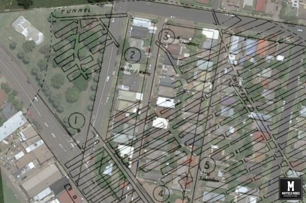
Please Note; image is not 100% accurate, its information sourced publicly and we have used the 1886 map to try to geo-reference the mines in current Mayfield. Currently, we are waiting for government agencies to show the most current information that includes any remedial work done. Once we receive, we will not be able to show the locations publicly, however we will better understand why subsidence events keep occurring (often in the same locations) and possibly where the water source is being generated in the abandoned mine network.
Mayfield Mine Map 1886

Mayfield Mine Map 1886

Filed Under: Uncategorized

Copyright © 2025